
By Gretchen Webster
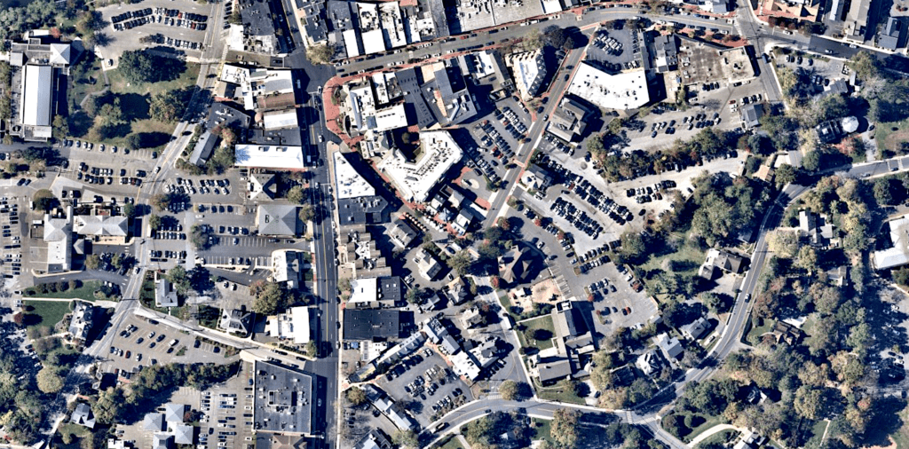
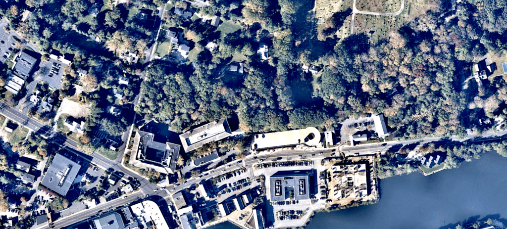
WESTPORT — The Assessor’s Office will use photographic flyovers of the town to keep track of changes and improvements to local properties for updating local tax rolls.
An annual $6,500 contract with the aerial photography company, Nearmap, to perform flyovers every six months was approved Wednesday by the Board of Selectwomen.
Hiring a second aerial photography company, Pushpin, to study and report changes made from one year to the next on local properties by comparing data revealed by aerial photos also was approved by the selectwomen. The Pushpin contract is for $2,650.
Aerial photos called “game changer”
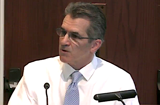
“This is a bit of a game changer for us,” Assessor Paul Friia told the selectwomen Wednesday. His staff will not have to go onto residents’ properties or schedule meetings with homeowners as often to ascertain property values.
Aerial photos will result in more equitable assessments townwide because they will provide information about property improvements more quickly and easily, he said.
The sooner changes in property can be added to the town’s Grand List of all taxable properties, the more accurate the list becomes, Friia said.
“This allows us to keep the mill rate stable … to spread the tax burden more equally among residents,” he said. “If [the town] is behind in assessments, it’s an additional burden on the taxpayers.”
Privacy of technology questioned
Selectwoman Candice Savin, a lawyer, said she is pleased the process would be more efficient because real estate transactions are often held up when recent assessment data is not available.
However, she added that she is concerned about privacy issues residents might have about planes flying over and taking photos.
Nearmap, according to information provided by the company, uses “airplane-mounted camera systems and processing software” providing clients with “high- resolution aerial imagery, city-scale 3D content, AI data sets and geospatial tools.”
Friaa said Nearmap performs flyovers over the entire state every six months, once in April (“leaf on”) and once in October (“leaf off”), and is not focused on any one property.
Assistant Town Attorney Eileen Lavigne Flug, who will review the contract before it is signed, said she didn’t see any privacy concerns with the contract because Google and UConn aerial photos are already used by the assessor. Flug said the contract restricts use of the photos to town employees and municipal business only.
Spotting changes that might go unreported
The assessor explained that changes to residential properties, such as new paving, additions, pools or sheds, will be better regulated with the addition of the aerial photography.
“The vast majority of Westport residents get permits, but there are people who do improvements and build additions just on their own,” he said. “Our whole goal is equity across the board so you don’t have a neighbor coming in and saying, ‘Why isn’t he paying for an addition he put on a year ago?’ ”
The aerial photos could also be used by the town’s Planning and Zoning and Conservation departments, Friia added.
When researching the Nearmap contract, he spoke to assessors in other communities who said the company’s aerial photos have proven to be accurate “within three- or four-inch differences.”
Harris Falk, a Representative Town Meeting member speaking as a member of the public, asked if the aerial photography could be used to survey the town’s streets and sidewalks to help speed repairs.
The town already has a contract with a company that monitors Westport’s road and sidewalks, First Selectwoman Jennifer Tooker said.


")


So, police drones bad. Assessor drones good?
“ Assistant Town Attorney Eileen Lavigne Flug, who will review the contract before it is signed, said she didn’t see any privacy concerns with the contract because Google and UConn aerial photos are already used by the assessor.” So the fact that someone has already abused our right to privacy means we don’t have the right to privacy? Geez!
Very creepy….
Big Brother has arrived in Westport.