
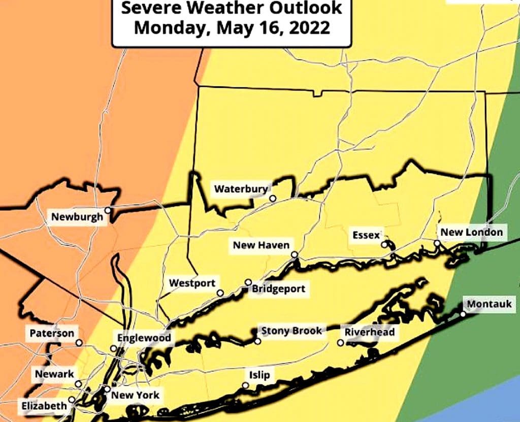
WESTPORT — Several days of sunny spring weather may come to a thundering halt — quite literally — later Monday, as severe thunderstorms are forecast for the region late this afternoon and tonight.
The storms, according to the “Hazardous Weather Outlook” issued early Monday for southwestern Connecticut, could unleash heavy rain, winds gusting up to nearly 60 mph and hail as large as one-inch in diameter, according to the National Weather Service.
Even “an isolated tornado” may be possible, the NWS predicts, in addition to the “damaging” wind and “large” hail.
Coastal area flooding could be triggered by heavy rains, the NWS warns. From 11 p.m. Monday to 2 a.m. Tuesday, with “up to one-half foot of inundation above ground level expected in vulnerable areas near the waterfront and shoreline.”
The greatest threat posed by storms, expected to be triggered by a cold front moving through the area, is from about 2 to 7 p.m. Monday, the NWS says, but that period could expand from 1 to 9 p.m.
Before the storms arrive, today’s high temperature is forecast to rise to the mid-70s under increasingly cloudy skies.
Overnight temperatures will drop to the low-50s, before skies clear.
Tuesday should mark a return to fine spring weather, with sunny skies and temperatures rising into the mid-70s, the weather service said.
To report a power outage or check on the status of one, go to this Eversource link, or call 800-286-2000.


Recent Comments