

By John Schwing
WESTPORT — A week after a rain-and-wind onslaught lashed southwestern Connecticut, another storm — potentially more powerful — is roaring up the East Coast with a pre-holiday package of weather woes later Sunday into Monday.
The massive storm, which battered Florida with heavy rain, strong winds and flooding Saturday, has been pounding the mid-Atlantic as it moves north along coast Sunday, triggering multiple warnings in a “Hazardous Weather Outlook” issued for this area by the National Weather Service.
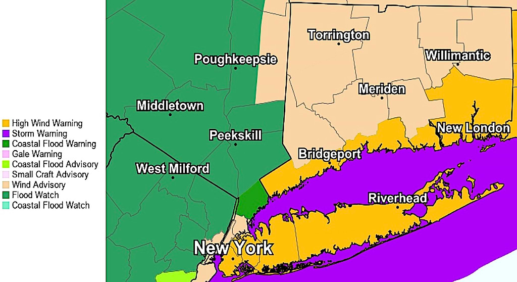
Among the warnings forecast for Westport and the region are:
- A “Flood Watch” in effect from 5 p.m. Sunday through 5 p.m. Monday.
- A “Coastal Flood Warning,” from 10 p.m. Sunday until 6 p.m. Monday.
- A “High Wind Warning,” from midnight to noon Monday.
Calling it a “major coastal storm,” the weather service warns the light rain falling across the region since Sunday morning will intensify by nighttime, with thunderstorms possible, as 1 to 2 inches of precipitation are possible.
As the high temperature will rise to the mid-50s by late afternoon, wind speeds will pick up from the about 25 mph Sunday evening to gusts clocked about 50 mph, the NWS says.
Rain, heavy at times, driven by gusting winds will buffet the region early Monday and continue through early afternoon, with the potential for as much as 1 to 2 inches of additional precipitation, according to the forecast.
Despite the foul weather, Monday’s daytime high temperature is expected to crest at about 60 degrees.
There also is a 50 percent chance of showers Tuesday, the NWS forecasts, as high temperatures cool to the mid-40s range.
Skies are expected to clear Wednesday, with a high temperature in the low-40s.
Power disruptions can be reported online at Eversource.com or by calling 800-286-2000. Customers who signed up for the power company’s two-way texting feature can send a text to report an outage and receive outage updates as they happen.


Recent Comments