
By John Schwing
WESTPORT — As a winter storm that battered the nation’s Plains and upper Midwest with blizzard conditions moves east Thursday, coastal Connecticut is expected to escape the brunt of the onslaught.
The storm, forecast to start sweeping across the region Thursday afternoon, is expected to unleash rain and gusty winds through late Friday.
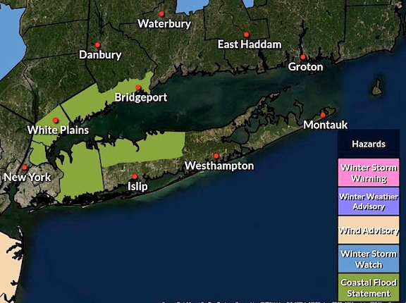
That has triggered a National Weather Service warning about possible coastal flooding in southwestern Connecticut from 3 to 6 a.m. Friday.
Up to several inches of snow, meanwhile, currently is forecast to fall in areas of upstate Connecticut through Friday night. Heavier snowfall is forecast for other parts of New England.
In Westport, Thursday is expected to be mostly cloudy, with temperatures rising into the low-40s. Rain should begin falling about 4 p.m. and continue steadily overnight through most of Friday, according to the NWS.
There is even a slight chance of the rain mixing with snow Friday night, the weather service says.
Wind gusts Thursday night through Friday may be clocked as high as 40 mph.
The storm is expected to clear out Saturday, with mostly sunny skies and temperatures rising to the mid-40s, the NWS forecasts.
The Sunday outlook is basically the same, although somewhat colder.







Recent Comments